Skip to content
Ben Brenner
  • Home
  • Blog
  • Websites
  • Film
  • Contact

Socio-Economic Tectonics

Posted on March 14, 2021 | by admin

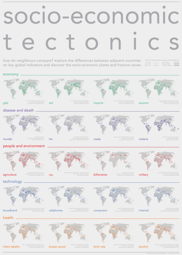
Great map from ESRI cartography master Kenneth Field showing inconsistencies between neighboring countries. Follow him on Twitter: @kennethfield

Socio-economic tectonics PRINT VERSION (arcgis.com)

Posted in Uncategorized

Post navigation

ArcGIS RemoteApp on mac from Windows Machine
Drought’s Footprint from NYT

Categories

  • ArcGIS Pro
  • Cartography
  • Cartography Examples
  • Google Sheets
  • Pet
  • Photography
  • programming
  • r language
  • Uncategorized

Navigation

  • Home
  • Blog
  • Websites
  • Film
  • Contact

Other Videos

  • Building Capacity for Resilience
  • About Here’s Life Africa Video
  • Association of National Estuary Programs Video
  • Backyard Pond
  • Dispatches From the Field
  • Litter – An Increasing Problem
  • Low Impact Development (LID)
  • MedReach 2018
  • Mon Louis Island Tip Restoration
  • Persons Service Corp. Construction Division
  • Preserving the Mobile Bay Estuary through Headwater Protection
  • Protecting Alabama’s Waters: Communities Partnering with EPA’s 319 Program
  • Stormwater & Pollution – Creating a Clean Water Future
  • The Absence of Doubt
  • The Dunes of Dauphin Island
  • The Flight of the Frigate Bird – An Omen of Rising Seas
  • The Path Toward Coastal Restoration
  • The Unintended Consequences of Convenience: A Story of Coal Ash in Alabama
  • Three Mile Creek – Transforming a Place, Uniting a Community
  • Transformations – The Butterfly Effect Across the Alabama Coast
  • Understanding Your Watershed

Contact Info

Email: ben.brenner@gmail.com
Phone: (251) 289-1236
LinkedIn: linkedin.com/in/brennerben
Instagram: @benbrenner
Twitter: @brennerben

© 2023 Ben Brenner | Bootstrap WordPress Theme